Cardify - Mistake Scan
Scan mistakes into organized study records with AI-powered solutions and feedback.
Use reverse image search for location when Google Lens, TinEye, or EXIF fails. Upload a photo and find where it was taken from visual clues.
Search for the place shown in an image, not just duplicate copies of the file.
Useful when Google Lens, TinEye, or classic reverse image search returns no helpful location.
Use screenshots, social images, and metadata-stripped photos to get a location estimate.
Tools and apps you might also like.
Scan mistakes into organized study records with AI-powered solutions and feedback.
Turn voice notes into tasks, reminders, and clean daily plans in seconds.
AI health companion for readiness, recovery, sleep, load, and life context.
Track expenses with voice input, receipt scan, and quick spending insights.
This page is for people who start with reverse image search but need a location answer. Upload a photo, screenshot, or saved web image, and GeoSolver looks for the visible evidence that can reveal where it was taken.
Classic reverse image search is great when the exact image is already indexed. Location search is different. It asks: what clues inside this image point to a real place?
If you simply want the shortest upload-first workflow, use Find Photo Location from Any Image. Stay on this page when your mental model is reverse search, Google Lens, TinEye, or image-source investigation.
| Search problem | Why this page fits |
|---|---|
| Google Lens has no useful result | GeoSolver reasons from roads, vegetation, signs, and architecture |
| TinEye returns 0 matches | The photo does not need to exist elsewhere online |
| EXIF or GPS metadata is missing | The workflow uses visible evidence instead of hidden file data |
| A screenshot has no source page | The model analyzes the scene itself |
| You need "where was this taken?" not just duplicate URLs | The output is a location hypothesis with supporting clues |
| Starting point | Use it when | Move to GeoSolver when |
|---|---|---|
| Google Lens | The image may contain a famous landmark, product, storefront, or readable text | Lens returns lookalikes but no clear place |
| TinEye | You need to find exact copies, older uploads, or source pages | TinEye returns 0 matches or only reposts |
| EXIF tools | You have the original camera file | Metadata is missing, stripped, edited, or copied |
| GeoSolver | The scene is unique, rural, cropped, screenshot-based, or not indexed | Use maps and satellite imagery to verify the hypothesis |
For a broader market comparison, see Best Reverse Image Location Tools.
Use this page for searches like:
If your goal is only to find duplicate copies of an image online, a classic reverse image search engine may still be the better first step. If your goal is to identify the place shown in the image, this location-focused workflow is the better fit.
If you upload a photo of a random field in Ireland, traditional reverse image search tools will likely return zero useful matches because that exact photo does not exist online. A location-focused workflow instead looks at the grass tone, road markings, sky color, and surrounding environment to infer Ireland from the clues inside the image.
Most people ask how to find location from image when the EXIF GPS data is missing. This tool uses visual evidence instead of metadata, which makes it useful for screenshots, old scans, downloaded social posts, and other images where the original file data is gone.
| Feature | TinEye / Google Reverse Image Search | GeoSolver Location Finder |
|---|---|---|
| Technique | Indexed image matching | Visual reasoning and geolocation clues |
| Best For | Finding source pages or duplicates | Finding where the image was taken |
| Works on Unique Photos? | No | Yes |
| Output | Similar pages and image matches | Likely place, coordinates, and reasoning |
For direct question-style searches, use Where Was This Photo Taken. For everyday upload-and-locate intent, use Find Photo Location.
Sometimes traditional reverse image search returns "0 matches" even though the photo contains clear geographic clues. The demo on our homepage for Kenya illustrates this contrast:
What we reported for this image:
How our location-focused reverse image search succeeded where TinEye had no matches:
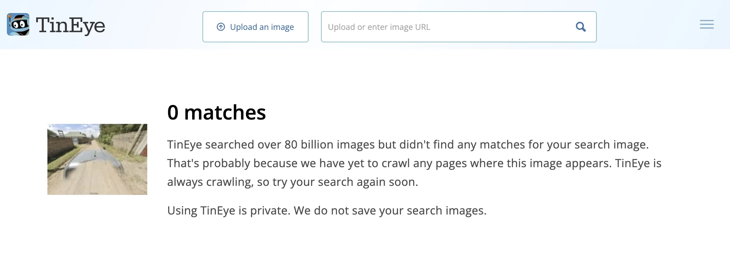
TinEye: 0 matches for the Kenya demo image. Open analysis
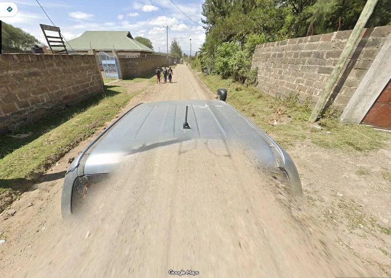
GeoSolver: location estimate and reasoning for the Kenya demo. View full analysis
Many users searching reverse image search location are actually working from screenshots. This is where traditional reverse search often fails and a location-first workflow starts to win.
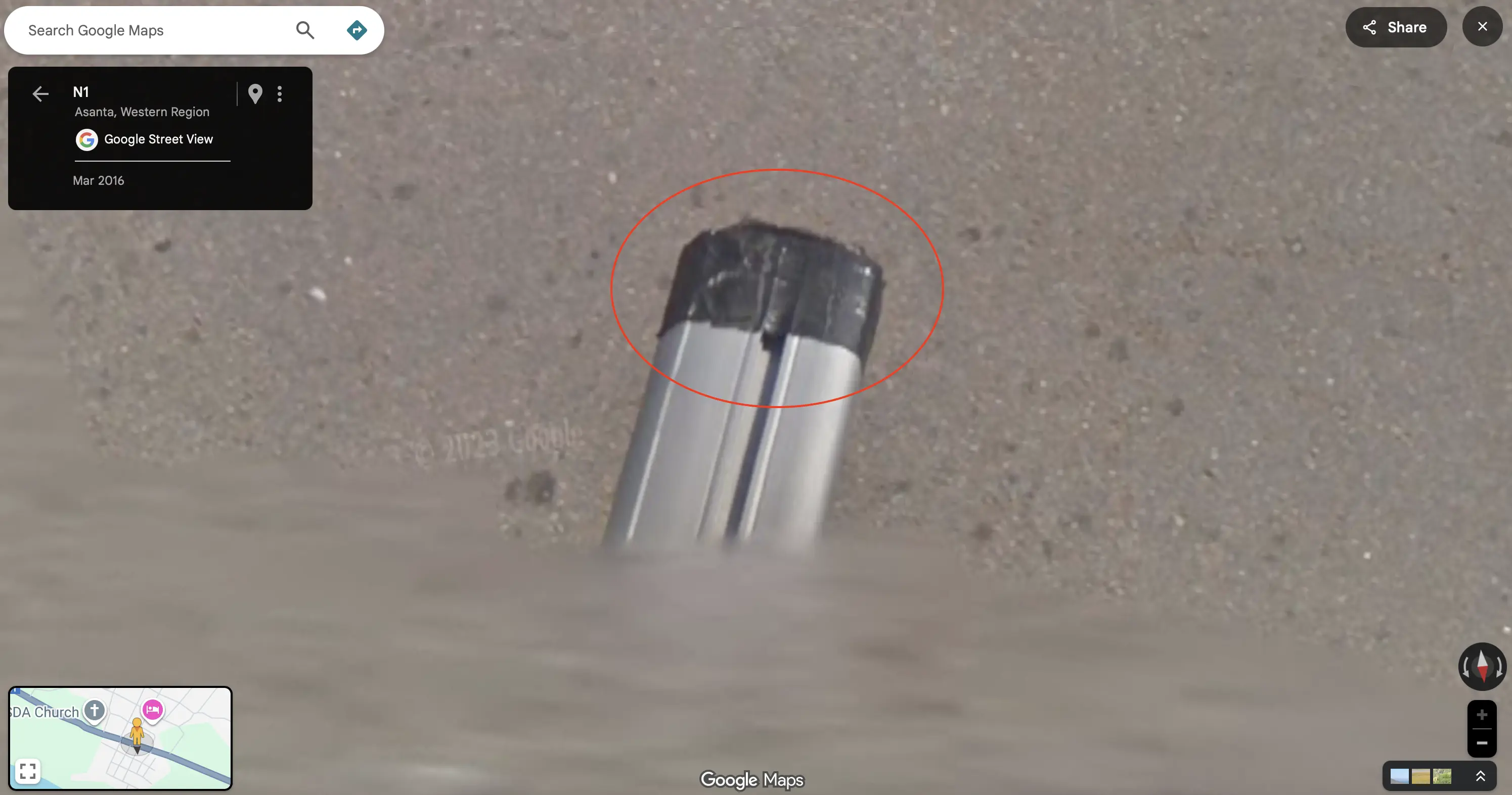
Screenshot-safe geolocation: even when metadata is missing, distinctive vehicle equipment can anchor the result.
Our system uses advanced computer vision and geographic knowledge to analyze images for location clues:
Location-focused reverse image search is useful because it does not depend on one exact web match. GeoSolver separates the visible evidence from the inference:
This is more durable than naming a specific model version, because the important user value is the visible evidence chain and the ability to verify it.
Unlike traditional reverse image search tools that only match pixels, this location-focused workflow:
Use the result as a lead, then verify it:
For the full process, read How to Verify AI Image Geolocation Results.
Yes, when the image contains enough visual clues. Traditional reverse image search finds matching copies online; GeoSolver uses location-focused visual reasoning to estimate the place shown in the photo.
Yes. That is one of the strongest use cases for reverse image search for location because screenshots often have no usable EXIF data and may not appear in any image index.
That is exactly when this workflow helps. A no-match result usually means the image is not indexed, not that the location is impossible to infer. GeoSolver analyzes visible geography instead of relying only on web matches.
No. EXIF can help when it exists, but this page is designed for images where GPS metadata is missing, stripped, or unreliable.
Usually yes. The wording is different, but the user intent is often the same: identify the place shown in the image. The direct question page is Where Was This Photo Taken.
Use this page when your mental model is reverse image search or when you are comparing against Google Lens, TinEye, or Picarta. Use Where Was This Photo Taken when your search is phrased as a direct question, and Find Photo Location when you just want the fastest upload-first workflow.
GeoSolvers advantage is particularly obvious when handling images that lack direct landmarks but contain plenty of "Meta" clues (such as Street View car features, vegetation, and architectural styles).
Picarta - Incorrect Prediction
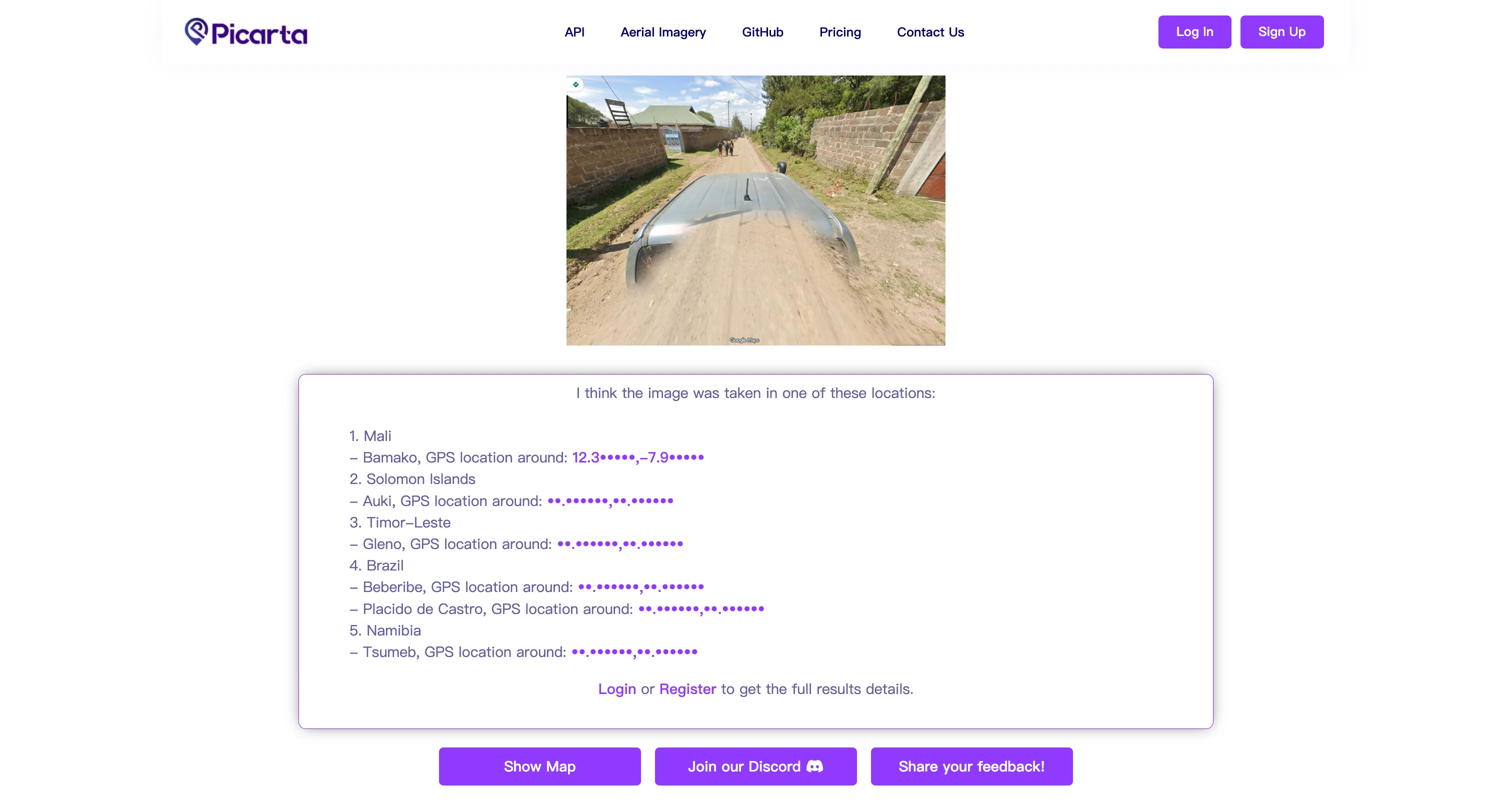
GeoSolver - Accurate Prediction
Our location-finding technology is developed by a team working across computer vision, geographic information systems, and artificial intelligence. The system leverages the latest generation of multimodal reasoning models to analyze geographic clues in images and turn them into practical location hypotheses.
This reverse image search tool has been rigorously tested across thousands of images from diverse geographic regions, including:
Our reverse image search solution is relied upon by:
We believe in transparency and accuracy. Every reverse image search result includes detailed reasoning and confidence scores, so you can verify the analysis yourself. Images are processed securely and not stored permanently, ensuring your privacy. Our system is continuously improved based on user feedback and new geographic data to maintain the highest standards of accuracy.
Ready to search the image location?
Upload an image and use AI reverse image search to estimate where it was taken.
Upload Image for Location Search
Continue this topic with the most relevant tools, learnable meta guides, and supporting articles.
Upload a photo, picture, or screenshot and use AI to find its likely location from visible clues. Works without GPS metadata, EXIF, or an indexed reverse image match.
Upload a photo, picture, or screenshot and find where it was taken. GeoSolver reads visual clues when EXIF, GPS metadata, or Google Lens matches are missing.
Upload a web image, repost, or screenshot to find where it is from. Useful when reverse image search gives links but not clear source context or location.
Master the most reliable meta in Geo Games. A complete guide to identifying countries by their traffic bollards.
Master Google Street View car meta for GeoGuessr. Identify countries by snorkels, roof racks, tape, mirrors, antennas, camera generations, and car blur.
Compare free Picarta alternatives for photo geolocation, screenshots, image location finding, reasoning quality, and pricing.
Grok can analyze uploaded images, but it is not a Google Lens-style reverse image search index. See what works, what fails, and the best workaround.
Identify GeoGuessr bollards by country with visual examples for France, Poland, Denmark, Germany, Italy, Peru, Australia, and more.
Our AI analyzes visual clues to estimate where the image was taken
Drag, paste, or click to upload your image