Cardify - Mistake Scan
Scan mistakes into organized study records with AI-powered solutions and feedback.
Advanced geoguessr ai analysis revealing geographic clues and location insights
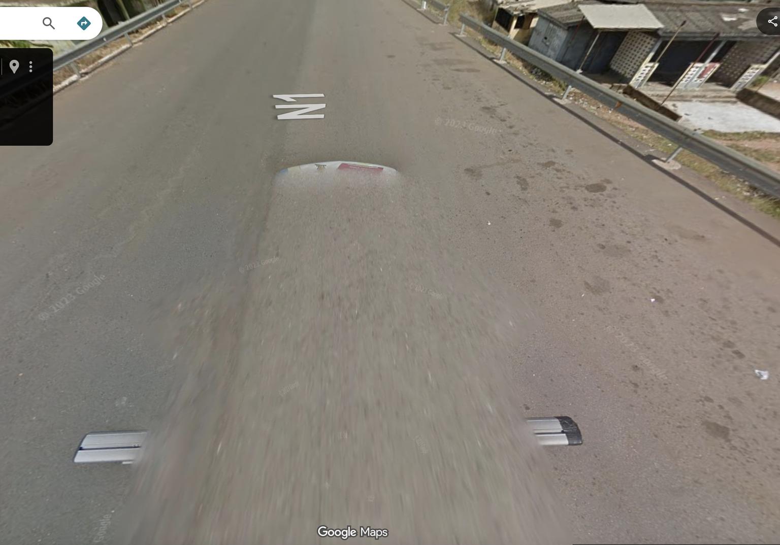
Visual evidence found in the image
Tools and apps you might also like.
Scan mistakes into organized study records with AI-powered solutions and feedback.
Turn voice notes into tasks, reminders, and clean daily plans in seconds.
AI health companion for readiness, recovery, sleep, load, and life context.
Track expenses with voice input, receipt scan, and quick spending insights.
The "N1" painted on the road is the most decisive clue. This is the designation for the primary national highway in Ghana, which runs along the coast.
This is a classic case of conflicting top-tier clues. The "N1" road marking is extremely strong evidence for Ghana. However, the visible roof rack is the type almost exclusively used in Kenya. When a strong in-world clue (road number) conflicts with a strong meta clue (the car), the in-world clue is often given more weight, as Google can occasionally move cars between countries for projects. The architecture and environment are consistent with Ghana. Therefore, the N1 marking is treated as the primary clue, while the car meta is noted as a significant but likely misleading contradiction.
The analysis hinges on weighing two conflicting, high-value clues. The "N1" road marking is a hallmark of Ghana's main highway. The Google car's roof rack is a hallmark of Kenyan coverage. Prioritizing the direct, in-world road identification over the car meta, the location is inferred to be Ghana. The surrounding architecture and environment support a West African location.
5.6037° N, 0.1870° W (General coordinates for Accra, along the N1)